3D Map Tours for Land and Plot Sales
Use 3D map tours for land and plot sales to connect drone context, plot availability, access, landmarks, and buyer decisions.

In this guide
Land sales content should connect maps, drone context, plot availability, and guided site understanding.
Short answer
Land buyers often need orientation before they need another brochure.
Land sales content should connect maps, drone context, plot availability, and guided site understanding. A useful test is simple: can someone open the tour, understand the place, and know what to do next without a separate explanation?
Spatial Studio can combine cloud generation from 360 drone, standard drone, phone, photo, and mixed site capture with map-led publishing. Mac local generation, Spatial Lens on iPhone Pro, PortalCam support, embeds, plot CTAs, and analytics give the same team options from field capture through buyer follow-up.
How to judge the workflow
| Land-sales question | Tour evidence |
|---|---|
| Where is the plot? | Boundary, plot ID, and position inside the plan |
| Can I reach it? | Road hierarchy, entrance, and travel context |
| What surrounds it? | Amenities, neighboring parcels, terrain, and views |
| Is it available? | Current status and a plot-specific inquiry |
Practical checklist
- Show access, roads, boundaries, and amenities.
- Connect plot cards to visual context.
- Use drone or splat media where it explains terrain.
- Add inquiry actions for selected plots.
- Track which plots and zones get attention.
Why Real Horizons is different
Real Horizons connects cloud splat generation with guided tour publishing. Spatial Studio supports captures from smartphones, 360 cameras, 360 drones, standard drones, DSLR/photo sets, and mixed media workflows. That matters when a land-sales team wants one path from drone, site, plot, or mixed capture to a usable map-led tour instead of stitching together separate tools for processing, viewer setup, publishing, and buyer follow-up.
Common mistakes
- Drawing attractive boundaries that are not tied to approved survey data.
- Starting close to one plot without showing the development.
- Treating current construction imagery as a completion promise.
- Publishing stale plot availability.
- Making mobile buyers hunt for the inquiry action.
Commercial packaging example
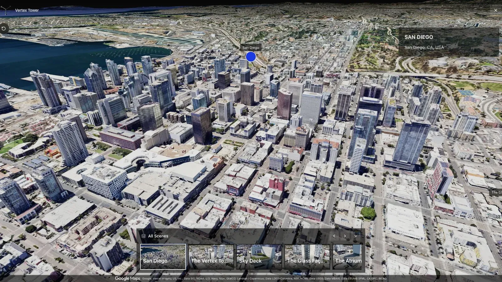
A city-scale map tour gives large sites the context that a room-by-room viewer cannot provide alone.
Lead with the entire site, then let buyers narrow to a phase, block, and plot. Mark boundaries as marketing context unless they come from authoritative survey data, and keep legal disclaimers near the map rather than burying them in a footer.
Give each plot a stable identifier shared with the CRM. A buyer who clicks plot B-14 should reach an inquiry that preserves B-14, campaign source, and tour source for the sales team.
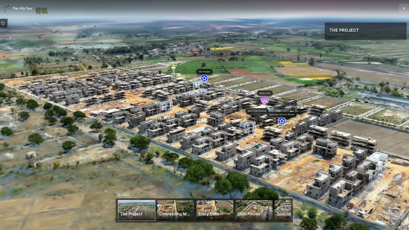
A land-development tour combines aerial context, waypoints, and site detail in one published view.
Mix media deliberately: a map for boundaries, a drone splat for terrain and context, ground capture for entrances or amenities, and time-stamped progress views when construction is active. Do not force one format to answer every question.
Before launch, verify plot data with sales, planning, and legal owners; test direct links for specific plots; and set a schedule for availability updates. Use analytics to see which zones precede qualified inquiry, not to infer demand from idle map views. For the broader workflow, read Splat Virtual Tour Software.
Questions land teams ask
Can a 3D tour show legal plot boundaries?
It can display boundary information supplied by the project team, but the visualization should not be presented as a substitute for an approved survey or legal plan. Identify the data source and state whether the overlay is illustrative.
How often should availability be updated?
Update whenever the sales system changes and show a review date. If live synchronization is not available, make the inquiry team the authority and avoid definitive “available” labels that no one owns.
Related reading
Next step
Generate a splat tour
Use the guide with your own project, or inspect a published example before starting.
Continue reading
Related articles
Commercial Use Cases
3D Property Damage Documentation for Insurance and Restoration
Plan 3D property damage documentation for insurance and restoration using photos, 360 capture, Gaussian splats, guided review, and clear evidence boundaries.
Read articleCommercial Use Cases
3D Tours for Campuses and Public Spaces
Plan 3D tours for campuses and public spaces with landmarks, routes, access notes, zone labels, and browser sharing.
Read article