Outdoor Gaussian Splatting Capture Guide
Plan outdoor Gaussian splatting capture for approaches, landmarks, scale, light changes, path clarity, and guided tour delivery.

In this guide
Outdoor capture works best when the route explains scale, approach, landmarks, and visitor decisions.
Short answer
Outdoor Gaussian splatting works when the capture explains a route through the site, not when it merely circles a landmark. Begin with the approach a real visitor would take. Cover entrances, junctions, boundaries, and the ground-level relationships that an aerial image cannot show.
Use drone footage for scale and overhead context. Use a 360 camera or phone for the places someone needs to inspect at eye level. A photo set can help static details. Spatial Studio accepts these supported inputs and can combine the resulting scene with a map, waypoints, labels, and other tour media.
Plan the tour before the flight or walk
Draw a rough route and mark three kinds of position:
| Position | Capture goal | Common failure |
|---|---|---|
| Arrival | Establish the entrance and overall scale. | Beginning too close to the subject to explain the site. |
| Decision point | Show forks, paths, gates, parking, or building access. | Moving quickly through the spot where visitors need orientation. |
| Feature stop | Capture the view, structure, plot, amenity, or landmark in detail. | Orbiting beautifully but failing to connect back to the route. |
If the site is too large for one continuous pass, plan overlapping zones. A clean transition between two well-captured areas is better than a long blurred connection recorded at vehicle speed.
Light, wind, and moving detail
Choose a time when the sun will stay on the same side of major surfaces during the capture. Long sessions across rapidly changing light can make one building appear to have several exposures. Avoid the harshest shadows unless texture and access leave no alternative.
Wind matters because foliage, flags, water, and loose fabric move between frames. You do not need a motionless world, but you should avoid making a moving tree canopy the main visual anchor for camera recovery. Walk where the scene contains stable texture such as paving, walls, rocks, signs, or built edges.
Choose the camera by altitude and access
- Use a phone when the route is compact and people will experience it from eye level.
- Use a 360 camera when broad coverage along connected paths saves time.
- Use a drone when height explains plots, roofs, terrain, or relationships that disappear from the ground.
- Use mixed media when no single altitude tells the whole story.
Spatial Lens can guide an iPhone capture. Spatial Studio for Mac offers local Apple silicon reconstruction for suitable projects. The web platform handles cloud generation and tour authoring, while drone, 360, DSLR, PortalCam, and existing splat inputs can feed the same project system.
Review the result like a visitor
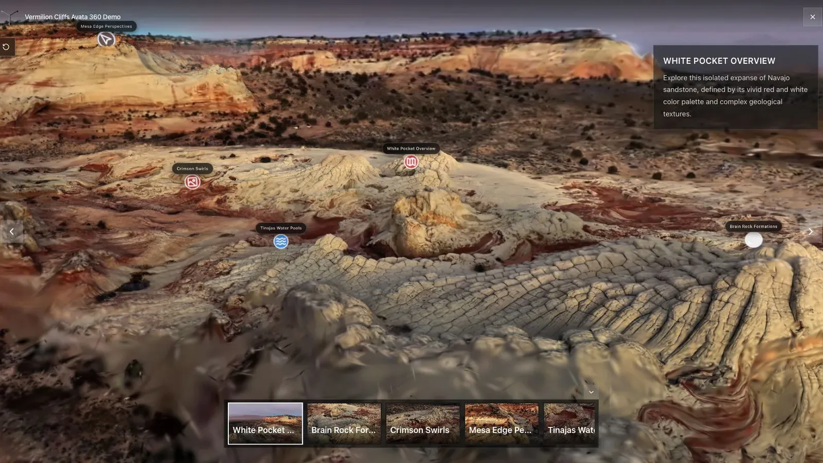
The opening angle should show both the subject and enough terrain to explain how a visitor reaches it.
Start on a phone. Can you identify the site before touching the controls? Follow the intended route and inspect fences, rooflines, thin poles, vegetation edges, and the transition between air and ground capture. Note problems that need a recapture separately from problems that need a better waypoint.
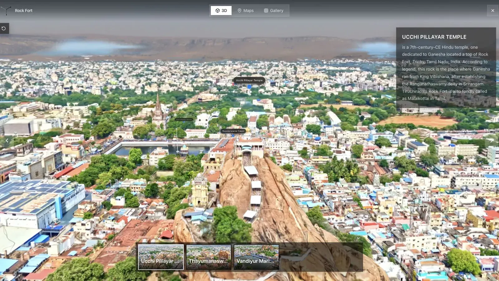
Large scenes become useful when named landmarks turn scale into a comprehensible route.
In Spatial Studio, set a wide establishing view, then add only the stops that change the visitor's understanding. A land sale might use Entrance, Plot A, Plot B, Utilities, and Viewpoint. A campus needs buildings and access routes. A venue may need parking, arrival, ceremony, and reception areas.
Finish with the action the tour is meant to support. That might be viewing availability, contacting sales, booking a site visit, or sharing the project with a planning team. Test that action inside the published embed, not only in the editor.
Frequently asked questions
Can drone video alone make an outdoor splat?
It can for suitable sites, but ground-level detail and access may be weak. Test a mixed drone and ground workflow when the visitor needs to inspect paths or entrances.
How large should one capture be?
There is no useful universal number. Split the site when the route becomes hard to overlap, light changes too much, or a single mobile scene becomes too heavy for the intended audience.
What should I do about moving trees?
Capture in calmer conditions when possible and keep stable built texture in view. Review foliage edges and distant backgrounds before accepting the reconstruction.
Is local Mac processing useful outdoors?
It can be useful for controlled projects and private iteration. Larger media sets may be better suited to the cloud workflow. Compare both on one representative site.
Related reading
Next step
Process an outdoor capture
Use the guide with your own project, or inspect a published example before starting.
Continue reading
Related articles
Capture Workflows
How to Make a Gaussian Splat on Mac from Photos or Video
Create a 3D Gaussian splat locally on an Apple silicon Mac from photos or video. Follow the capture, processing, review, export, and publishing workflow.
Read articleCapture Workflows
Photogrammetry vs Gaussian Splatting on Mac
Compare photogrammetry and Gaussian splatting on Mac by output, geometry, visual quality, capture, editing, measurement, hardware, and delivery workflow.
Read article